In his famous poem, John Donne wrote, “No Man is an Island.”
We maintain that no building is an island, except for that lighthouse on Bishop Rock, but that’s an exception that proves the rule.
Every building exists in context. Buildings come together to form neighborhoods, and then cities.
A monumental skyscraper blends right into the skyline of Manhattan, but the same structure would look jarringly out of place in the Italian countryside.
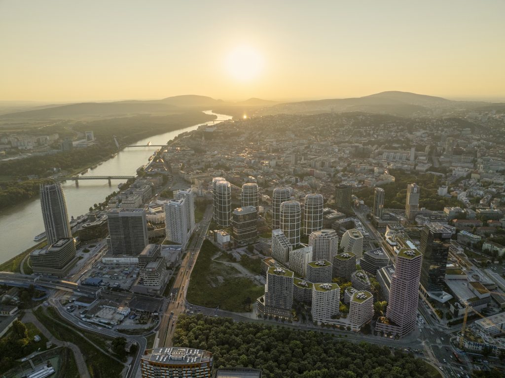
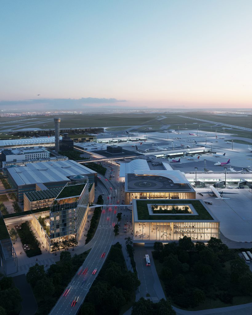
To capture this in architectural visualization you need a bigger frame. Aerial, or an aerial render, is exactly that; it’s a visualization of the building and the surrounding area that shows how the project is going to look as a part of a larger whole.
When do you need an Aerial Render?
Every architectural visualization has a purpose. Some are purely informational, others are mood pieces, designed to evoke a particular emotion. Some are commercial, created to be used for marketing purposes, meant to be displayed on billboards and ads, while others are more technical.
Bird’s eye view aerial shots are typically informational and technical. They help understand the urban context of the project. For that reason, these visualizations typically have a crisp, realistic style and neutral lighting.
That being said, a lot of developers use striking aerial imagery for marketing purposes, helping future buyers better understand the locale, attracting their attention to nearby amenities like parks, schools, and playgrounds.

How are aerial renders made
The process typically starts with the coordinates. After the 3D team receives the location they use publicly available maps and resources to get references of the area, as well as photo references from the customer (when available).
Photographic Aerials
Based on the references, the team sets up test cameras and gives instructions to the drone pilot. A skilled pilot can copy the angle of an existing reference photo or capture an image based on the requirements set forth by the 3D team: angle, lens, depth of field, etc.
Relying on drone footage can be tricky for many reasons. First of all, to operate a drone you need a drone pilot license, which isn’t easy to obtain. Additionally, the company has to be registered as a drone operator with the local Aviation Autority. As an example, monolot (our studio) has 3 licensed drone pilots, and we are able to do our own aerial photography all over Europe.
Some countries forbid drone photography altogether or have an extremely complicated process to obtain a license locally, forcing 3D teams to either rely on local operators or consider other options.
Weather and light are another huge factor. Especially if the visualization asks for specific weather or lighting conditions, a particular time of year, or other hard-to-replicate conditions.
Sometimes the clients are ready to provide their own photos. Every studio has different requirements; ours are fairly simple: we need high quality (4K or 8K) and good visibility.
When the photos are ready, 3D artists then match the light and the colors with the photo to make sure the model doesn’t look out of place.
Even with high quality pictures extra work is often needed.
Photos capture life. Construction sites, bright advertisements, company logo’s on top of buildings — even the cars with their multitudes of colors can be simply too distracting.
Archviz artists sometimes have to do a little magic, making sure the background works with the design.
Also, same as people, some buildings in the background are simply not very photogenic. We prefer to think that all buildings are beautiful. We simply caught them at a bad time.
Full 3D Aerials
When using an aerial photograph isn’t possible or practical, the entire environment can be modeled in 3D. The key advantage of this approach is that it’s easier to blend the building and surroundings together since every building in the frame is a 3D model. But that’s where the advantages end.
Not all cities stand on flat ground, and gauging the exact heights of hills can be tricky just by looking at top-down satellite images.
To save time modeling, it’s possible to get a basic 3D model of the environment from public and commercial resources, but these are never usable as-is because of scale and quality issues. They have to be remodelled, retextured, and scale adjusted.
Consequently, full 3D aerials are more costly. Not only is the number of hours the team has to spend modeling higher, but the additional expense of acquiring extra assets and references adds up quickly.
When a render features a lot of natural elements, like terrain features or vegetation, it adds another layer of complexity, creating more workload.
Modeling a real jungle is very different from modeling a concrete one, it’s a complex task that requires a particular set of skills (most studios have specialists that focus on landscaping). It’s especially true when natural features have to be copied exactly.
But at the end of the day, the end result is worth the effort. Even without hyper-realism, a modern full 3D aerial render looks extremely lifelike, making you feel as if you yourself are flying over the stunning vistas.

Finishing Touches
In both cases, the design is integrated with the environment, creating a beautiful picture.
Light and atmospheric effects like mist or clouds can be used to enhance the mood and bring the composition together.
More than other renders, aerials need to be tied to a place. The color of sunlight and even the shape of the clouds are often very particular to a location. Try putting a panorama of Dubai under a pale Norwegian sun and you will see what we’re talking about.
Depending on the nature of the render, adding cars and people can breathe life into the picture. Making sure they fit their environment, like not wearing shorts and driving convertibles in the dead of winter, goes without saying.
Bird’s eye view — the best view
Aerial renders are not easy to do, but we can’t deny they are beautiful. Every one of them is a labor of love. If you like architecture as much as we do, check out our Stories page for more visualizations.
And if you want the camera to soar over your design, turning your project into a breathtaking panorama, drop us a message at newstory@monolot.studio


